
Hurricane Irma Churns Westward
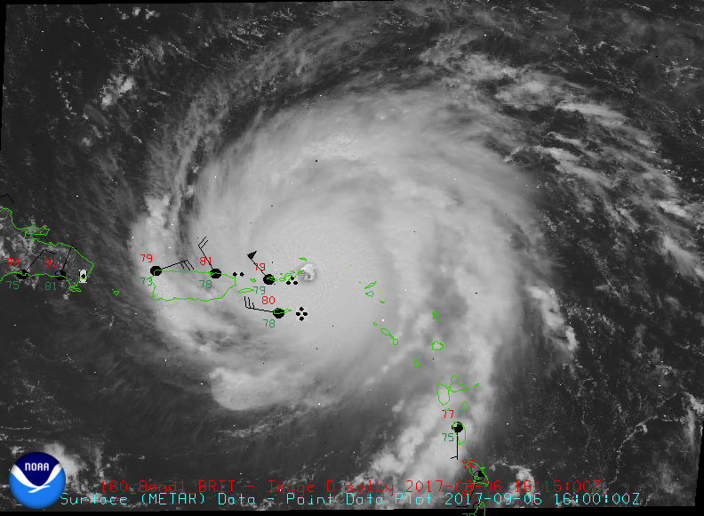
As Irma approaches the Northern Virgin Islands today (figure to the right), many Floridians are wondering just how far west she’ll go. With sustained winds upwards of 185 mph (and higher gusts) the Category 5 storm has a minimum central pressure of 920 mb – which now ranks her as one of the top 5 most intense storms in the Atlantic basin.
Track guidance from this morning (figure below) has shifted slightly eastward – placing Irma somewhere between the east coast of Florida and the western Bahamas late Sunday evening. In part, the uncertainty in its path is related to the interaction of the cyclone with a large scale trough that is moving west-to-east across the US. When will the storm makes its turn northward? Will it be as sudden as these models suggest? Looks like we may have to wait until Irma arrives in the Central Bahamas on Saturday morning to know for sure.
How this plays out, only time will tell. In the meantime the public should head all official watches and warnings.